
Map a Manheim Township Street
A street-by-street search begins with the parcel, not a name. Lancaster County's assessment application lets a researcher use an address range and municipality to identify parcels on one road. A returned card can give a site address, owner field, parcel or account number, property class, land use, sale criteria, and structure criteria. Treat that result as an assessment record. The County says its web data can lag recent property or tax changes and does not guarantee accuracy or reliability.
From that record, use the parcel's deed reference in the Recorder route, then compare the recorded parties and property description. The trail is street, parcel, assessment record, deed reference, and recorded parties. It is not a shortcut to an occupant roster. For a historic address clue, check the title page and geographic scope of a relevant volume in the Manheim Township city directory collections before treating an old listing as township coverage.
- Open Lancaster County Property Tax Inquiry and use Advanced Search. Enter the street name without its suffix, use low and high house numbers for a segment when useful, and select Manheim Township.
- Keep the parcel number, site address, owner field, deed reference, and Township/Municipality field from a matching assessment result. Do not treat an owner mailing address as proof of residence.
- Open LanCo View 2.0 to place the parcel among roads, parcel lines, aerial imagery, and the surrounding geography.
- Use the deed reference with the Lancaster County Recorder of Deeds. When a historic book and page are known, the county directs visitors to guest access and the Online IQS Infodex document route.
- For a permitted election-related purpose, request the statutory Street List through the state process and follow its signed-use and no-internet-publication restrictions. Historic directories can add dated context only after their volume scope is checked.
Note: A number range narrows the parcel search, but it does not turn a street query into a list of residents.
Manheim Township Street Directory Records
Different custodians answer different address questions. The county assessment system identifies the current parcel record. LanCo View adds geography and map context. Recorder material describes a land transfer through named parties and a legal property description. Township records may document a narrowly described municipal file, subject to its release rules. The table separates those sources so a street directory search does not blur ownership, mail, and occupancy.
| Address record | Custodian | Useful street detail | Access limit |
|---|---|---|---|
| Assessment record | Lancaster County Property Assessment | Parcel or account number, owner name, site address, sale and structure criteria | Free wEdge search; update timing can lag |
| Parcel map | Lancaster County GIS | Parcel location, acreage, dimensions, roads, aerial imagery, deed reference | Free LanCo View map; it is not a household list |
| Recorded deed | Recorder of Deeds | Grantor, grantee, book and page, deed and recording dates, property location | Guest public-records route and Infodex; party based |
| Township permit or planning record | Code Compliance or Planning and Zoning | Status, property-information, or focused municipal record trail | CityView or RTKL route; building files have a special restriction |
| Historic directories | LancasterHistory and Lancaster Public Library | Dated name and address context where the volume covers the area | Digital run is 1843 to 1922; verify each volume |
| Voter Street List | Pennsylvania Department of State | Defined election-record fields for an authorized request | $20 electronic list; restricted and cannot be published online |
The useful link among these records is the parcel and deed reference. A road name alone can be ambiguous. A parcel key helps keep one address separate from another similarly named road, especially where a postal-city label crosses a municipal boundary.
Search wEdge by Manheim Township Street
The county's wEdge Property Tax Inquiry has Basic and Advanced Search. Basic parcel-number searching accepts a number-only account entry. Advanced Search supplies the road and owner criteria needed for an address-based workflow. The county guide specifically says to enter a street name without Street, Avenue, or Road, then select a municipality when a name is common.
The screenshot below comes from the County's property inquiry. It shows the two search modes and the address-oriented controls used for a Manheim Township road search.
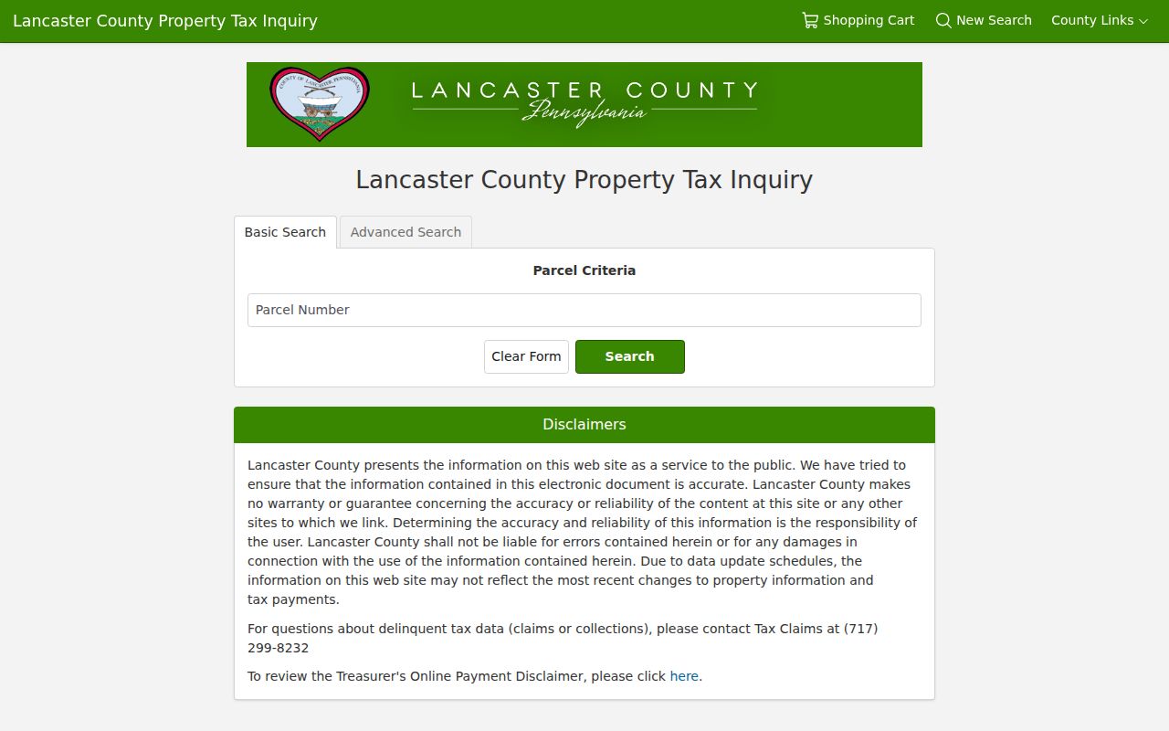
The form distinguishes owner criteria from site criteria. That design matters because a returned mailing address may be where correspondence is sent, while the site address identifies the physical taxed parcel.
Manheim Township Street Directory Fields
Use only fields the public form exposes. The exact labels below come from the accessible Advanced Search screen. They make a street segment more precise without asserting who occupies the resulting parcels.
| Field | Form type | Address use | Format or limit |
|---|---|---|---|
| Parcel Number | Text | Open a known parcel | Basic Search uses numbers only |
| Owner Name | Text | Find an assessment owner record | Match behavior is not stated |
| House Number Low | Text | Start a street segment | Optional address range |
| House Number High | Text | End a street segment | Optional address range |
| Street Name | Text | Find parcels on a road | Use street name only, without suffix |
| City | Text | Refine a postal-city entry | Verify municipality separately |
| Township/Municipality | Dropdown | Narrow to Manheim Township | Optional but important for common roads |
| Property Classes and Land Uses | Dropdowns | Further parcel filtering | Options were not exposed in the crawl |
| Sale Price and Sale Date | Range fields | Review recorded-sale context | Date display uses MM/DD/YYYY |
| Year Built and Square Footage | Range fields | Refine by structure data | They are not occupancy fields |
Do not add a ZIP claim to this workflow. The accessible wEdge form exposes city and municipality fields, but not a verified ZIP filter. The public county route remains address, road name, and municipal geography.
Follow a Manheim Township Street Map
LanCo View 2.0 is the County's free public parcel-information application. Its official description names parcel data, acreage, dimensions, deed reference, aerial imagery, roads, and interactive map context. Use a selected parcel to see the shape of a street segment, then consult the separate assessment and Recorder systems for their own records.
The County GIS landing page is shown in this source image for the Manheim Township street map. It is the starting point for the free viewer, not proof of a full list of layers or a neighbor-selection command.
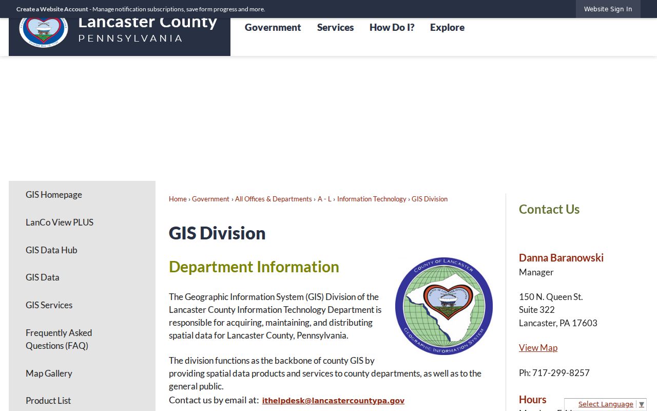
County guidance confirms map pan and zoom, parcel selection, layers, base-map controls, measure, and print functions. Exact live layer options, a free ZIP-wide search, and a specific adjacent-parcel button were not verified in the accessed source, so they should not be assumed.
Note: The GIS Division says its applications may not function during Sunday morning maintenance.
Keep Manheim Township Address Keys Separate
Three labels can point to the same land record while meaning different things. Reading them correctly prevents an address result from becoming an unsupported claim about a person. Keep the physical parcel key, correspondence address, and recorded-land description together, but do not treat them as interchangeable.
- Parcel
- A county assessment unit for a piece of land, commonly identified by an account or parcel number.
- Situs or site address
- The physical location used to identify the assessed parcel.
- Mailing address
- An address used for assessment correspondence. It can differ from the situs and is not proof of current occupancy.
- Legal description
- The recorded land description, often tied to a deed book and page when a current street number is absent.
- Grantor and grantee
- The seller and buyer roles shown in a recorded transfer, not a list of everyone at the property.
Manheim Township is municipal district 390. Lancaster can be the postal city for township land, and Lititz can be a postal designation for northern township addresses. Neither label alone settles whether a parcel is in the township, the City of Lancaster, or Borough of Lititz. Confirm the Township/Municipality field and the mapped parcel boundary.
Move From Street to Deed Reference
A deed reference bridges the assessment record to the Recorder. Lancaster County directs users to Public Records Search and Online IQS Infodex. The county's guest instructions say that a known book and page can be entered through the Go To Document tab, using the book letter and page. That route is more reliable than assuming the historic index offers a universal address box.
Record the book or volume, page, grantor, grantee, date signed, recording date, and property description. A recording date can be later than the deed date. When a street number is missing from an older instrument, the legal description, lot or tract wording, adjoining owners, and mapped context can carry the trail instead.
The County Archives' house-history approach starts with the present deed and works backward through the seller and buyer roles. That same discipline makes a street-by-street search clearer: identify one parcel first, then evaluate its recorded chain rather than extrapolating a whole road from one result.
Read Manheim Township Deed Indexes
Lancaster County's first recorded deed dates to 1729. The documented historic grantor and grantee index series runs from 1729 through 1980, in seven date ranges: 1729 to 1893, 1894 to 1925, 1926 to 1939, 1940 to 1953, 1954 to 1965, 1966 to 1975, and 1976 to 1980. The index gives party roles, a deed-book reference, deed date, recording date, and property location.
These are party-name indexes. Begin with the first few letters of a surname and the first letter of a given name, then expect spelling variations in older work. The book conventions omit J and V volumes. A historic address may use a lot, tract, road, acreage, or adjoining-landowner description instead of a modern house number.
That long land trail is useful local context, but it is still a record of transfers. A historic recorded owner is not automatically a present resident or a full household account.
Manheim Township Street Permit Limits
For a focused municipal question, the CityView portal offers Building Department, Zoning Permits, status and fee, submission, and Property Information entry points. The formal records route is the township's Right-to-Know process, including JustFOIA and written requests by the channels the township lists.
Building-permit applications, plans, and similar files are not an open plan library. The township says it releases them only to the owner of record, permit applicant or holder, design professional of record, or a third party with written owner permission. Valid identification and, when needed, separate authorization are also required. A public map or parcel card does not remove that limit.
The township normally has five business days to respond under its RTKL process unless the statutory extension procedure applies. Its form says the first ten letter-size copies are free, then $0.25 each, and lists $5 for a certified copy; other charges may apply. A request should name the record and give a property address, time frame, record type, or party names when available.
Street Lists Follow Pennsylvania Rules
Pennsylvania's personal voter-status service is for a voter to check that person's registration. It is not a public web directory. The separate Public Information List, Street List, Walking List, and Full Voter Export are controlled by 25 Pa.C.S. §§ 1403 to 1404 and 4 Pa. Code §§ 183.13 to .14. The requester form also cites 25 Pa.C.S. § 1207(b).
The state Street List includes defined voter-record fields and costs $20 per county in electronic form. A requester signs an affirmation against prohibited commercial or other uses and against posting the information online. It can support a permitted election-record inquiry, but it cannot be copied into a web listing. Voting history means recorded participation in elections, not how a person voted.
Protected and confidential address records remain protected. The Pennsylvania Address Confidentiality Program provides a substitute address in designated records for qualifying participants; it is not a path to uncover a protected physical address.
Manheim Township Street Boundaries Shift
Lancaster City annexed land from Manheim Township from 1931 through 1952. The result is an irregular southern boundary with township islands inside the city. A road may therefore carry a Lancaster postal label while its parcel record remains in Manheim Township, or a nearby address may belong to the separate city.
Use the assessment municipality, district 390, historic legal description, and the LanCo View parcel boundary to resolve that question. Historic maps can help connect a road to an older tract description. No official accessed source documented a township-wide street renumbering or renaming project, so no such event should be assumed when an old address fails to match a current number.
Note: Check a historic directory title page and a deed description before connecting an older street reference to a modern parcel.
Manheim Township Street Directory Limits
A street directory can document an assessed parcel, a recorded owner, a land-transfer party, a dated directory entry, or a limited municipal record. It cannot establish every person who sleeps at an address. It does not open motor-vehicle or utility customer records, override a sealed or limited-access record, or reveal an Address Confidentiality Program participant. It also cannot turn an owner mailing address into a current-residence claim.
The proper response to an incorrect official record is to contact the custodian, such as Assessment, the Recorder, elections, a court clerk, or the relevant state office. For a suspect deed or unexpected transfer, preserve documents, check the official Recorder system, and use the appropriate official reporting channel. The Pennsylvania Attorney General's February 2026 warning describes forged transfers and related pressure tactics, but no verified Lancaster County property-fraud-alert enrollment was located.
Lawful use. Use address-linked records for a legitimate personal, civic, family-history, or property purpose. Pennsylvania's stalking and harassment statutes, 18 Pa.C.S. §§ 2709 and 2709.1, make repeated unwanted conduct and misuse of personal information serious matters; do not use records to stalk, harass, intimidate, or harm anyone.