
Manheim Township ZIP Code Directory Coverage
Two delivery ZIP codes have verified Manheim Township examples. Neither represents a township-wide boundary drawn by the county or USPS in the research material. Instead, the table uses official township contacts and county polling-location examples. When a result matters, confirm the parcel’s Township/Municipality field and mapped boundary. Manheim Township is municipal code 390. That is more reliable than the postal city printed after an address.
| ZIP | Verified township examples | Postal designation | Use with care |
|---|---|---|---|
| 17601 | Municipal Office on Municipal Drive, central and southern township examples, and multiple township contacts | Lancaster | Also serves addresses beyond the township; select municipality 390 in county tools |
| 17543 | Faith United Methodist, Landis Homes, Neffsville Fire Station, and other township polling-place examples | Lititz | The Lititz label can still identify a Manheim Township parcel |
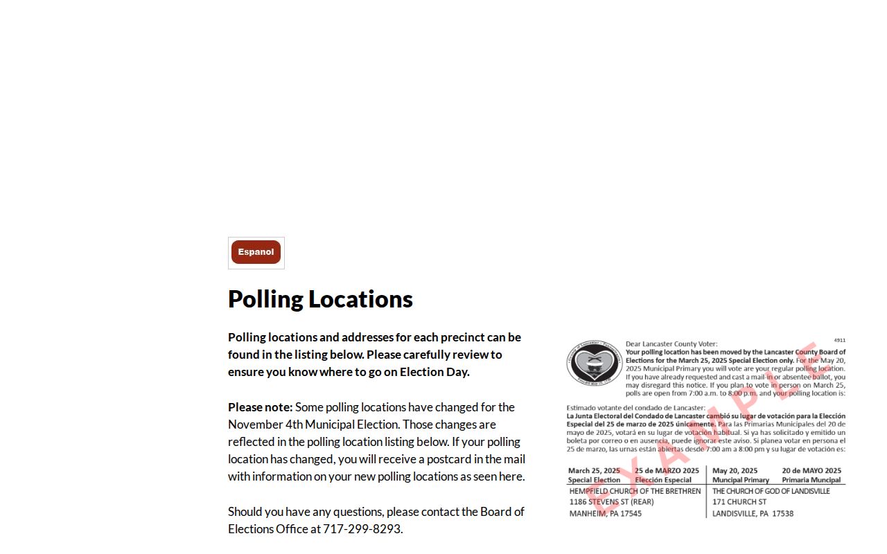
Lancaster County’s polling-location records are strong local evidence because they place Manheim Township election districts at known civic locations using both postal designations. They are not a roll of current residents. The township occupies about 22.6 square miles immediately north of Lancaster City, and its delivery labels cross municipal lines. Postal geography is useful, but it is not the government boundary used for tax, planning, or election administration.
Two Manheim Township ZIP Code Geographies
Manheim Township has a practical north and south postal split. Northern and northeastern township examples can use Lititz 17543, while municipal offices and many central or southern examples use Lancaster 17601. The county’s current polling locations list 1290 Fruitville Pike, 1001 E. Oregon Road, 200 E. Oregon Road, and 3110 Lititz Pike as Lititz 17543 examples. The Township’s municipal, planning, parks, and police contacts use Lancaster 17601. Both patterns belong to the same municipality when the parcel record says Manheim Township.
Lancaster County polling locations provide the official address examples behind this local postal comparison.
The distinction also prevents two frequent errors. Manheim Township is not Manheim Borough, which uses county municipal code 400. The word Lancaster may refer to a postal city, yet Lancaster City is a separate municipality. Use the county assessment municipality field and LanCo View parcel boundary to settle jurisdiction rather than relying on a city name after the street address.
Note: A postal city is a delivery designation, while municipal code 390 identifies Manheim Township in county materials.
USPS Fields for Manheim Township ZIP Codes
The official USPS lookup is the delivery check. It offers an address route, a city-and-state route, and a ZIP-to-cities route. USPS expressly says a result does not confirm that a particular person or company is at the address. Record its result as a delivery ZIP, then use the county parcel systems for municipal context. This is the most important accuracy boundary in a ZIP record check.
| USPS mode or control | Required information and result purpose |
|---|---|
| ZIP Code by Address | Street address plus city and state, or street address plus ZIP; returns the delivery ZIP route. |
| ZIP Code by City and State | City and state; returns ZIP codes USPS associates with that city name. |
| Cities by ZIP Code | A ZIP; returns cities USPS associates with that ZIP. |
| Go to | Runs the selected lookup mode. |
USPS ZIP Code Lookup should be used after a county assessment or map check has identified the parcel or street.
Note: A USPS answer verifies delivery geography, while county systems establish the municipality assigned to a parcel.
Search a Manheim Township ZIP Code by Address
A precise address workflow stays focused on the parcel rather than trying to obtain a ZIP-wide list. The Lancaster County wEdge advanced form has City and Township/Municipality fields, but the inspected form did not expose a ZIP field. The County’s free GIS landing page also did not publish a ZIP filter, and the paid LanCo View PLUS description does not state that it searches by ZIP. There is no verified local tool here for returning every parcel or person in one ZIP.
- Enter the known street address in the USPS address mode and note the delivery ZIP exactly as returned.
- Search the county assessment system by street name, low and high number where useful, then choose Manheim Township from the municipality list.
- Compare the returned site address, parcel or account number, and municipality. Keep a correspondence address separate from the site address.
- Open LanCo View for parcel boundary, roads, acreage, dimensions, aerial context, and deed reference.
- Use the Recorder only when a documented transfer question remains. Do not describe that chain as a ZIP-wide people search.
Once a ZIP has narrowed an address, the Manheim Township by-street directory explains the separate street and parcel record chain. A parcel map can show land context, not every person associated with an address.
Lancaster County GIS is the official source for the LanCo View route used after the address and municipality are confirmed.
LanCo View helps check parcel placement, acreage, dimensions, deed reference, roads, and aerial imagery. Its public landing page does not establish a free ZIP search, so keep the delivery ZIP, municipality, and selected parcel as separate keys.
Manheim Township ZIP Code Boundary Mismatches
City boundaries and delivery routes do not move in lockstep. Lancaster City annexed land from Manheim Township from 1931 through 1952. The result is an irregular southern boundary and township islands surrounded by the city. A record may therefore carry a Lancaster postal label even though the parcel is in Manheim Township. Historic deed descriptions and a map may be more useful than a modern street number when researching an older address near that boundary.
The county’s first recorded deed dates to 1729, the same year Manheim Township was established. That long land-record trail is valuable for a property history, but recorded owners, mailing addresses, and delivery ZIPs answer different questions. Check the parcel’s municipality, legal description, and historic map context before treating a postal designation as an old boundary fact.
The County Archives keeps historical map context that is especially useful where a modern postal label obscures an older land description. Its public map route includes eighteenth-century warrantee material and maps dated 1824, 1864, 1875, and 1899. Those maps can bridge roads, tract names, and land patterns, but they do not automatically translate an old reference into a current street number. Pair a historic map with the parcel’s deed reference and the municipality field. The county has not documented a township-wide street renumbering event in the reviewed material, so an individual address needs source-by-source verification.
Postal-label myth. Lancaster 17601 can be a valid Manheim Township delivery address, and Lititz 17543 can be one as well. Neither label alone identifies the municipality.
Manheim Township ZIP Address Keys
County systems distinguish the physical parcel from the address used for mail and the description used in a deed. That distinction is essential when a ZIP code search produces a familiar street but the municipal result differs from an assumed city. The wEdge search separates Owner Name from Site Criteria, including house number, street, city, and Township/Municipality. A number range can refine a segment, while a street-name-only search can reduce formatting problems on common roads.
- Situs or site address
- The physical address used to identify a taxed parcel. It is the key for an assessment search.
- Mailing address
- The correspondence address an owner may use for tax records. It is not automatically the site address or proof of occupancy.
- Legal description
- The deed’s land description, which may retain a tract, lot, acreage, road, or adjoining-owner reference when a street number changes.
- ZIP+4
- An added postal delivery detail. It refines mail routing but does not set a township boundary.
- Carrier route
- A mail-delivery grouping. It is not a county parcel or municipality classification.
Note: Keep the site address, correspondence address, legal description, municipality, and delivery ZIP as separate research keys.
Manheim Township Postal Landmarks
Planning character areas can make a local address easier to understand without becoming postal boundaries. The adopted 2035 plan identifies Neffsville Village around Lititz Pike, Oregon Village around Oregon Road, traditional neighborhoods, suburban and agricultural areas, airport and enterprise areas, corridors, parks, and southern reinvestment areas near Routes 30 and 283. These names can explain an address’s setting and development era.
They should not be treated as ZIP polygons, neighborhood rosters, or county jurisdiction labels. A northern address with a Lititz designation can sit in Manheim Township, and a southern address with a Lancaster designation can do the same. The county parcel map and municipality field remain the local check. The plan is useful context when a historic legal description, street, and modern postal label do not line up neatly.
Note: Planning character areas provide place context but do not replace the county parcel boundary or USPS delivery result.
Limits of Manheim Township ZIP Records
Neither USPS nor the county systems provide a verified public filter that lists every resident within 17601 or 17543. USPS confirms delivery geography, not a person at an address. The assessment system can identify a listed owner connected to a parcel, but an owner or correspondence field does not establish a household. LanCo View maps parcels, roads, imagery, dimensions, and deed references, not private resident rosters.
Address protections matter as well. Pennsylvania’s Address Confidentiality Program supplies a substitute address to qualifying survivors for designated records, including voter registration and marriage licensing. Voter Street Lists have their own signed-request route, $20 county fee, and restrictions against internet publication. Do not try to work around a protected address or use a delivery label to infer information the official record does not provide.
Lawful use. Use ZIP and parcel records for personal, lawful research. Respect protected addresses and do not use public information to stalk, harass, intimidate, or harm another person.